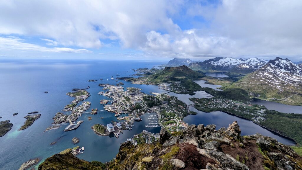
This is a must do hike if visiting the Lofoten islands, it’s a 2.4 mile hike up 1900 ft to a jagged peak with a spectacular view overlooking Svolvaer.
Quick Lofoten islands travel tip: Svolvaer is the largest town in Lofoten and there are many accommodations, it’s a very easy stepping off place to visit most of Lofoten. We stayed in Svolvaer for 6 days and it was perfect!
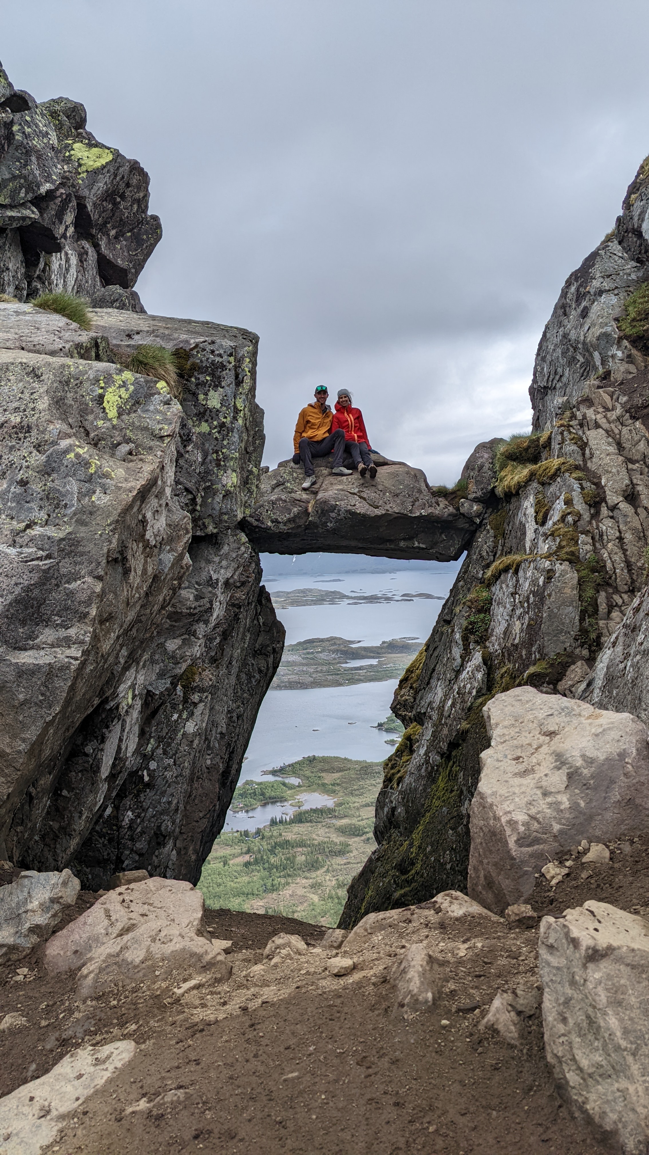
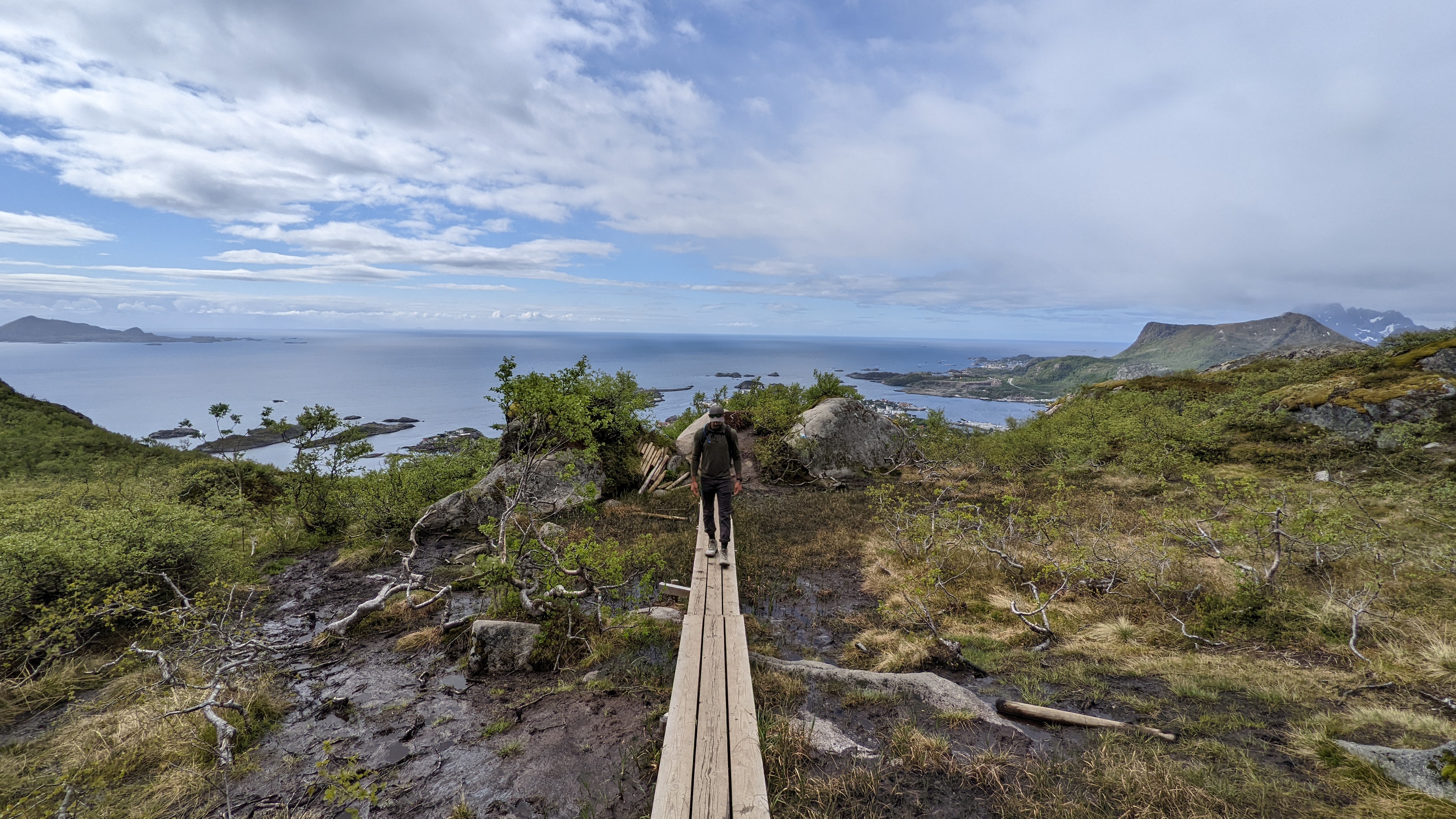
Okay back to the hiking details: There is a paid car park at the entrance to this hike if you get started early enough there will be spots. If no spots it’s about at 15 minute flat walk from town. This hike is not for the faint of heart, it does not let up in steepness till the top, which is way up there. You start out taking sherpa stairs up till you reach a flatter section of wood bridges(shown in 3rd picture) over a muddy bog. If it has just rained the trail will be very muddy, I highly recommend a good pair of hiking shoes, would not do this hike in tennis shoes. Once past the boggy section you continue climbing up switchbacks till you reach the rock bridge shown in 2nd picture. If you are brave definitely hop onto the bridge for an epic picture. You continue to climb up switch backs till you reach the ridgeline and finally the top, on a clear day you could see for miles, however our day was not so clear but we were still able to get a pretty epic picture from the top, 1st picture. The hike took a little over 3 hours round trip with stops for pictures. We did this hike in the beginning of June and it was 44 degrees fahrenheit, with variable clouds and sun. for all hikes I recommend to start cold and pack ample cold weather gear and this hike was not exception. On the way up it was steep and we were comfortable in shortsleeves and pants, on the way down we put on our puffy jackets, hats and gloves, that ocean breeze was cold. Here is the all trails link for reference. Happy hiking!